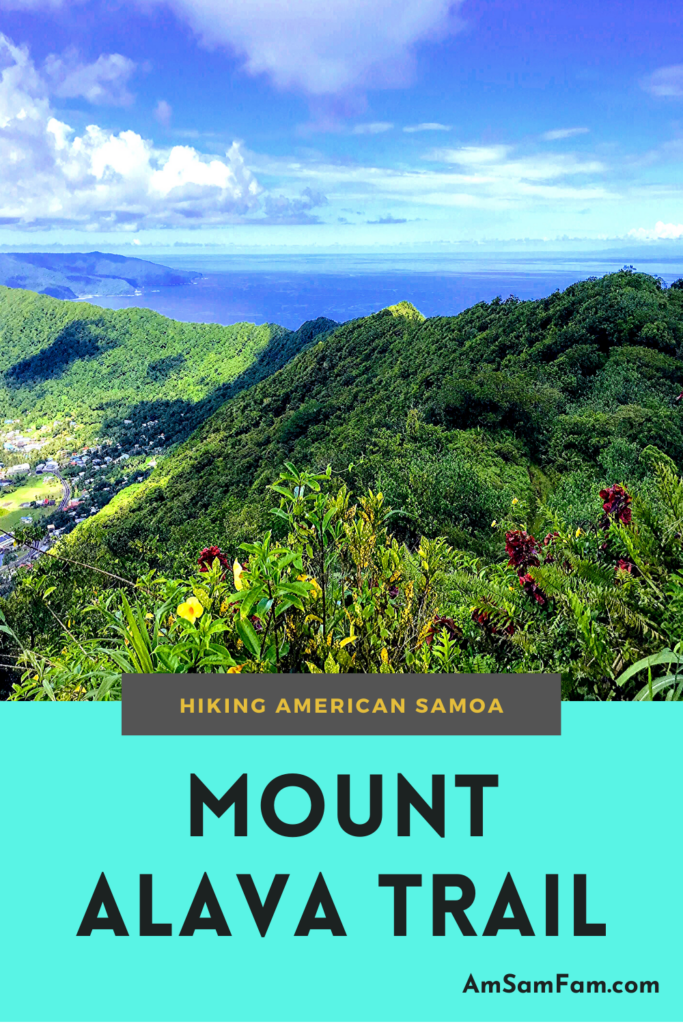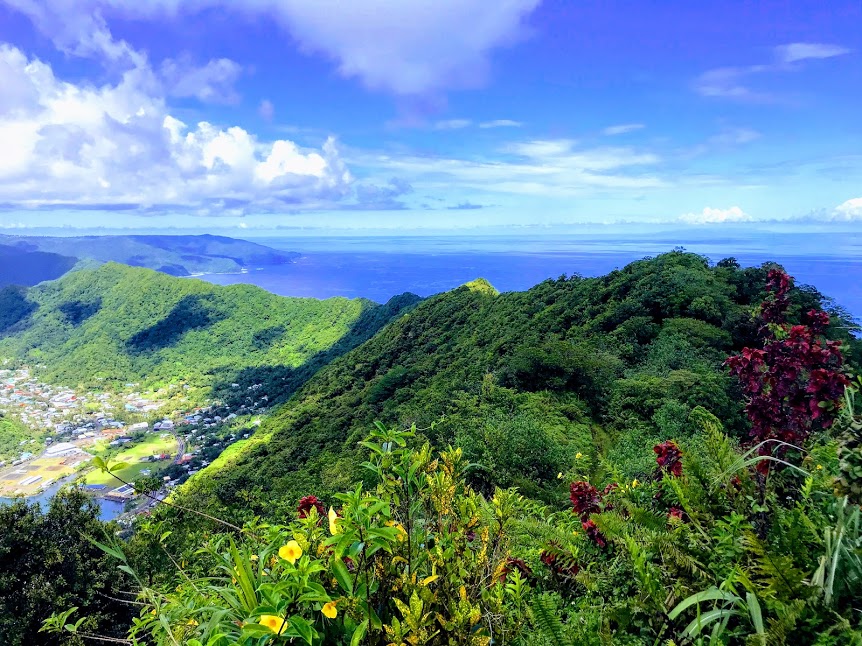
The Mount Alava Trail is the most visited trail within the National Park of American Samoa and for good reasons too. The trail is easy to find, easy to follow, and provides just enough challenge that it makes you work to conquer its peak. Plus, the views from the top are unmatched from anywhere on Tutuila.
Mount Alava Trail Basics
Distance: 7 miles/11.3 km
Difficulty: Challenging
Island: Tutuila
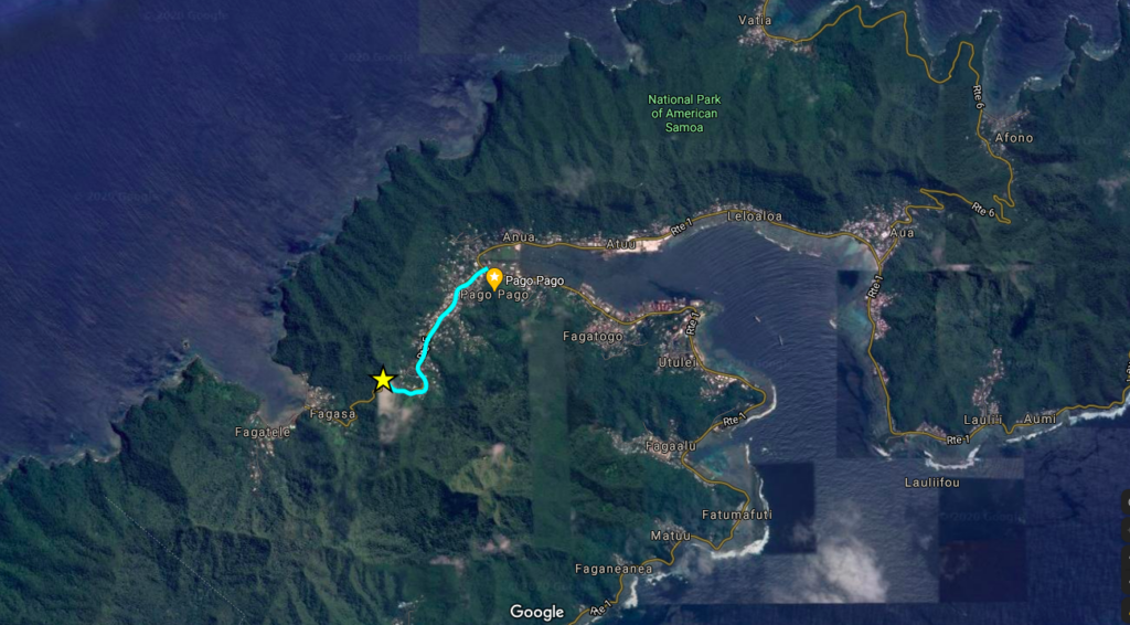
Start Point: Fagasa Pass. From the Main Road in Pago Pago, look for a sign pointing to the National Park. Turn north on the road east of Napa Auto Parts and travel 1.2 miles up the mountain, to Fagasa Pass.
End Point: Same as the start point, unless you want to continue on to the Adventure Trail, which continues from the summit of Mount Alava and ends in the village of Vatia.
Parking: There is off-street parking through the stone wall, at the top of Fagasa Pass.
Hiking the Mount Alava Trail
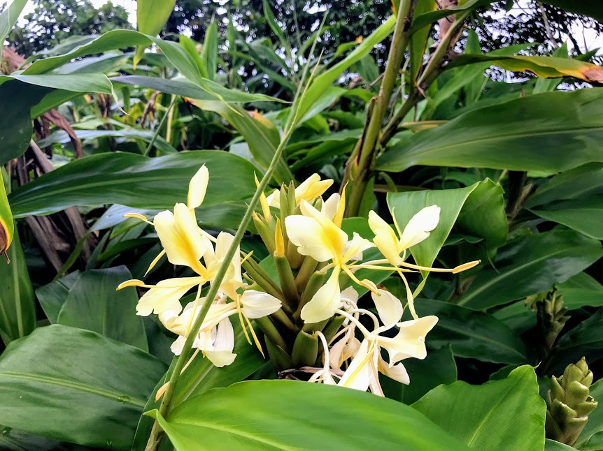
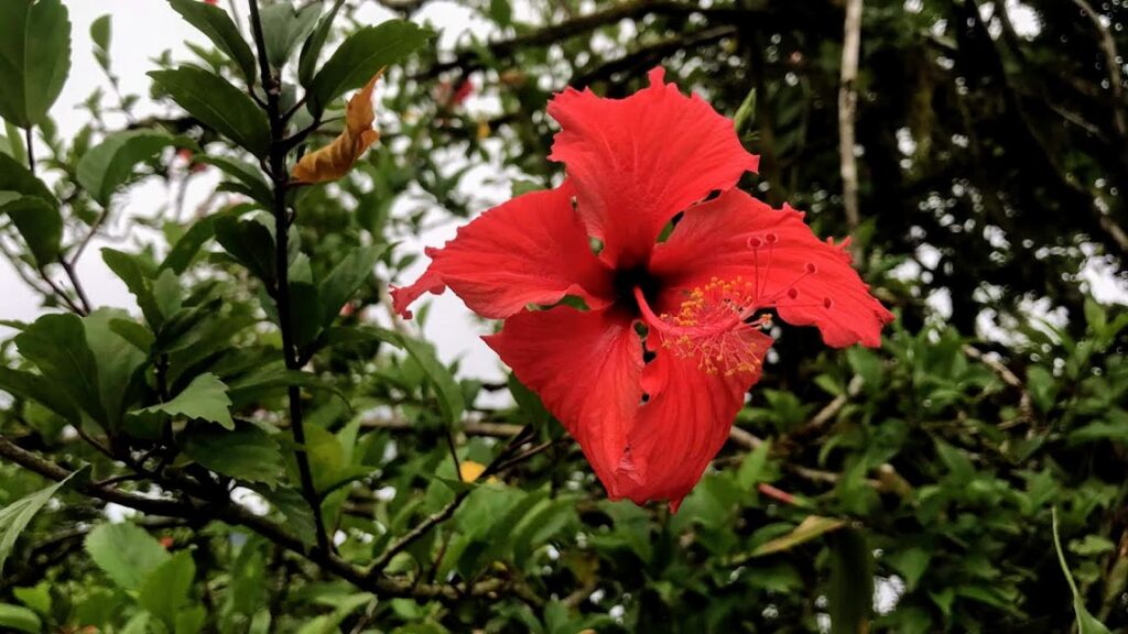
Before we even start hiking, we always take just a moment to marvel at the views of Fagasa Bay, otherwise known as Dolphin Bay, because of its shape. Also, Fagasa Bay is known to be a favorite spot around Tutuila for dolphins to give birth and it’s one of our favorite places to snorkel.
The Hike
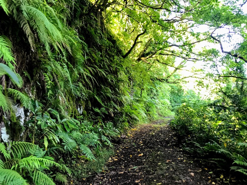
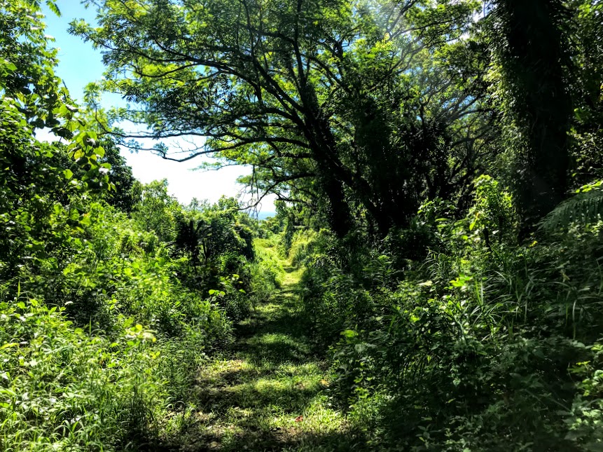
The first mile of the trail is mostly shady, with some trickier steep spots over smooth stone. This was as far as we made it on our first attempt at hiking the Mount Alava Trail, because of the difficulty and our own inexperience. If that’s as far as you can make it, rest assured that you can feel proud of reaching this milestone and having experienced tackling this challenging rainforest hike, even if you couldn’t make it to the top.
Once you pass the mile mark, the trail continues to follow the natural rise and fall of the mountain ridge. Enjoy every descent and find comfort in the fact that every climb means another descent on your way back down. There are plenty of shady spots to rest and breaks in the foliage to offer spectacular views.
The Summit
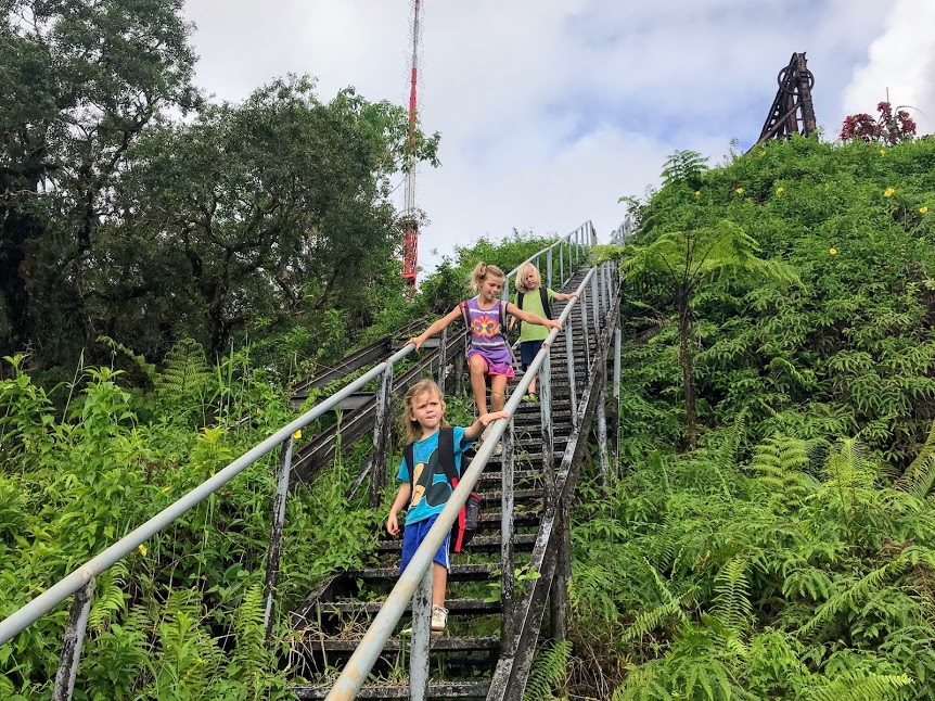
When you think you might never reach the stairs, just about 3 miles, you’ll see the radio towers above the tops of the trees telling you you’re almost there. But don’t celebrate just yet, you’ll still have another 1/3 mile to the stairs. Then, before you know it, you’ll round a corner and exhale in relief as the stairs finally come into view. Take your time climbing the stairs, giving yourself a moment to relish the sweeping views all around, especially look for the winding trail you just conquered, as you’ll be able to see it going all the way back to Fagasa Pass.
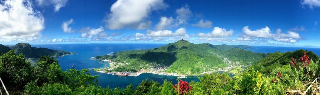
As you reach the top of the stairs, there is a platform to your right. From here, you can get the best pictures of the harbor and much of Tutuila Island. This is an especially favorite spot for selfies overlooking the harbor.
But you’re not finished yet.
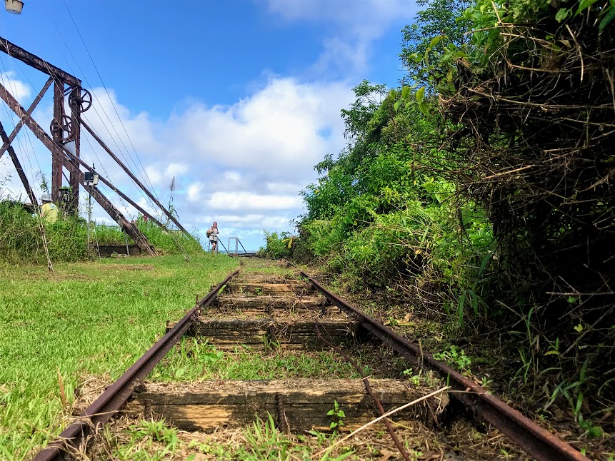
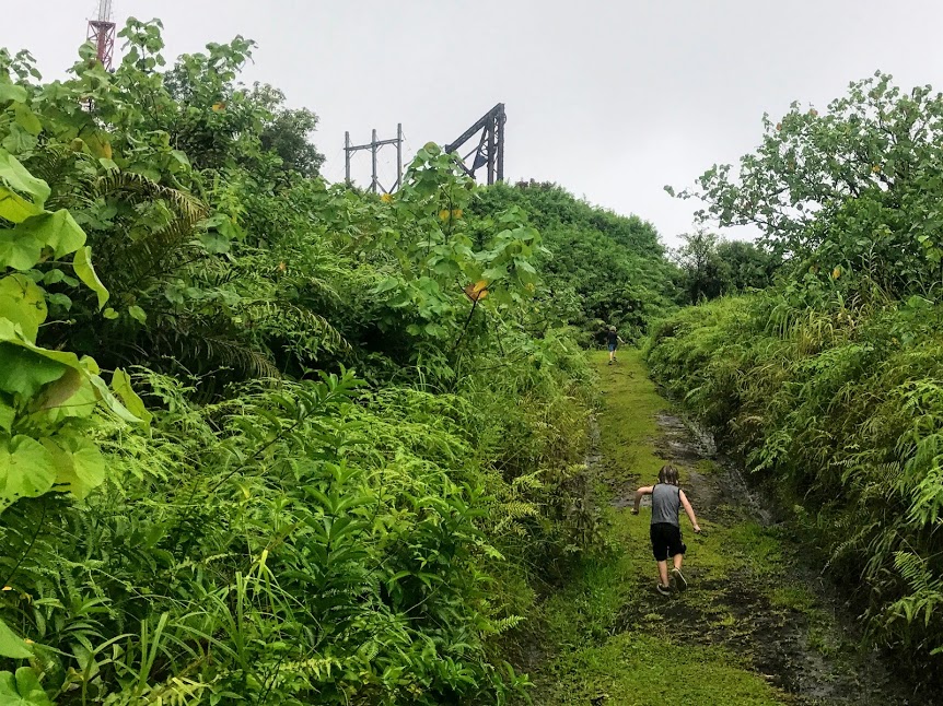
You’ll follow the abandoned tram tracks, to the radio tower. Then, take the trail to the right of the tower leading up to the fale at the summit.
This fale is the ideal place to rest, to enjoy the views, and to eat a picnic lunch. Our kids like to bring cards or something to do while we rest at the top. You know, after all that hiking, they couldn’t possibly want to just lay back and relax. Haha However, I am perfectly content to lean back against one of the wooden beams of the fale and close my eyes, enjoying the sounds of nature and the cool breeze blowing across my face.
The Way Back
When you’re ready to head back down, take a look around and make sure you haven’t left any garbage laying around. Whatever you bring in, please make sure to bring it back out. Always leave the fale and trail better than you found it.
You may want to pause one more time at the top of the stairs and soak up every last bit of those stunning views.
As you make your way down, watch your footing. Remember those inclines on the way up? They are now descents that carry you down. Just watch your step, what looks like solid ground, has a tendency to slip out from under your foot.
We always hike out much faster than we hike in; maybe it’s the rest at the top that renews our energy, gravity helping us down, or just the promise of finishing. Either way, we usually have much less complaining or pulling kids along.
Considerations
The Mount Alava Trail is one of the better maintained trails in the National Park, which makes the journey easier. The trail is wide most of the way. After the stairs at the top, the trail can become more overgrown. Still, you should still have no problem making your way to the fale at the summit.
The tricky spots are the steep parts that can become quite muddy and slippery when it’s been raining. Even when it’s dry, the steep parts can be challenging due to loose sand and dirt over smooth rocks.
Apply plenty of sunscreen and mosquito repellent before starting the hike. The mosquitoes can be thick in the shady spots and the sun shines hot where there is no shade. It’s best to prepare for both.
The stairs at the top are getting older, but they’re still sturdy. A few times there has been orange tape wrapped around a step, indicating that something was amiss. As we’ve returned though, the steps were no longer loose, thanks to the dedication and hard work of our Park Rangers.
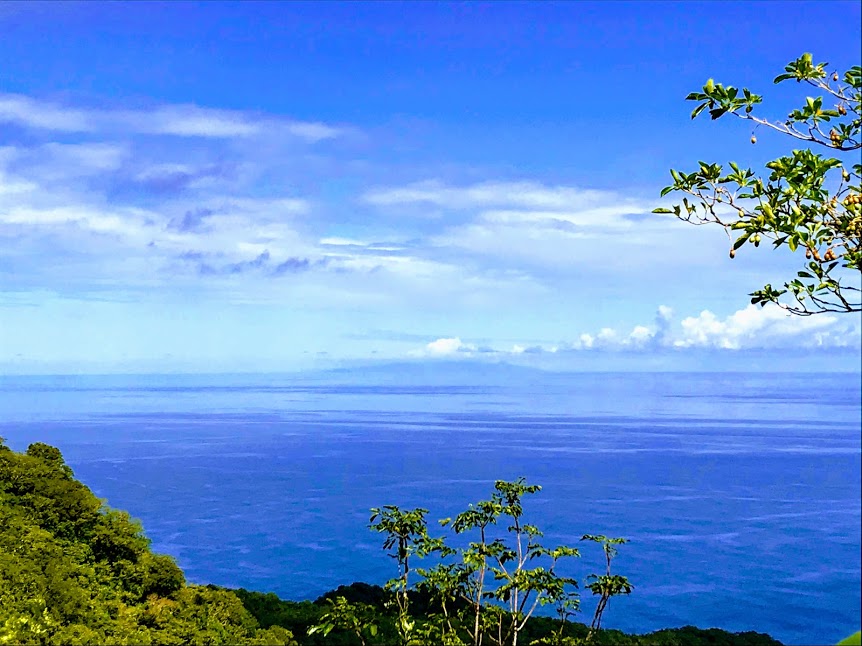
The trail is long, but the views from the top are worth it! From the top of the steps, you can look back and see Pago Pago Harbor and the whole west side of Tutuila stretch out in front of you. There are almost uninterrupted 360° views of the entire island from the fale! On clear days, you might even be able to see Manu’a and Upolu (Independent Samoa) from the summit and Upolu from about half-way up the trail.
If you’re wanting to continue to the Mount Alava Adventure Trail, you will take the stairs on the opposite side (east side) of the fale, which will lead down to Vatia. Arrange transportation ahead of time.
The trail is challenging, but the first time we completed the full trail Kip was only three. The key is to take is as slowly as you need, come prepared with plenty of water and snacks, and make it fun.
Mount Alava Trail Wrap Up
Bring plenty of water, a reliable camera, and a heart ready to work hard and be rewarded beyond belief. The Mount Alava Trail will leave you tired but wondering when you can take on the challenge again.